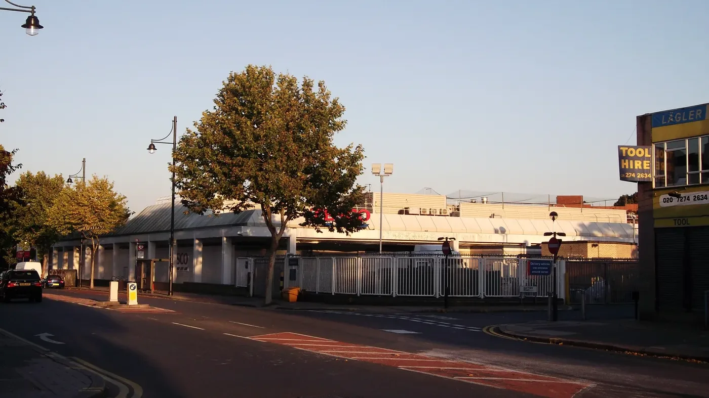

The Tesco on Acre Lane could become 180 to 210 homes over a new store. Lambeth adopts the plan on 14 October, with sites in Streatham and West Norwood too.
The Tesco superstore on Acre Lane in Brixton could be rebuilt as a new supermarket with 180 to 210 homes above it. That is the council’s estimate in a new planning document that names 13 sites across Lambeth for redevelopment.
Lambeth’s Cabinet backed the document, called the Site Allocations Development Plan Document, on 23 September. The council’s decision record lists the recommendations as approved. Full Council is due to adopt it on 14 October.
Once adopted, the plan carries full weight when the council decides planning applications on these sites. It does not grant permission for anything. Each scheme would still need its own application.
The sites in our area
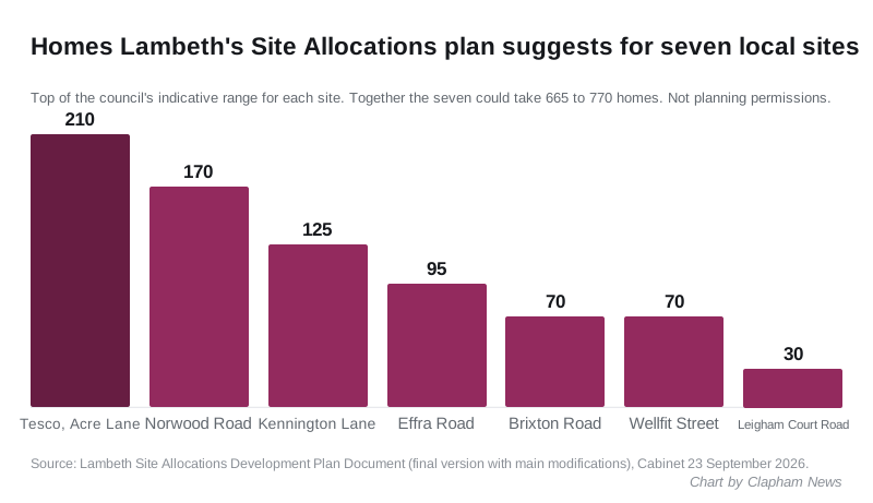
Eight of the 13 sites are in Brixton, Streatham, West Norwood, Loughborough Junction and Kennington. For seven of them, the plan gives a rough number of homes:
| Site | What is there now | Homes the plan suggests | Height limit |
|---|---|---|---|
| Tesco, 13 Acre Lane SW2 | Supermarket and 229-space car park | 180 to 210 | No tall building (over 45m) |
| 300 to 346 Norwood Road SE27 | Shops, flats, workshops, a church | 150 to 170 | Tall buildings only if enough land comes together, up to about 31m |
| 6 to 12 Kennington Lane and Wooden Spoon House SE11 | Builders’ merchant, NHS offices | 115 to 125 | A 50m building at the front |
| 51 to 57 Effra Road SW2 | Retail park, two large sheds | 85 to 95 | 14m in the east to about 26 to 29m in the west |
| 330 to 336 Brixton Road SW9 | Petrol station, NHS clinic, offices, workshops | 60 to 70 | No tall building (over 45m) |
| Wellfit Street and Hinton Road SE24 | Light industrial units | 50 to 70 | Up to 40m |
| 35 to 37 Leigham Court Road SW16 | Council car park and disused public toilets | 25 to 30 | No tall building (over 25m) |
The figures come from the final version of the plan, which the council published with the Cabinet papers. Added together, these seven sites could take 665 to 770 homes.
An eighth local site, on the corner of Coldharbour Lane and Herne Hill Road, is a place of worship. The plan says any scheme there must replace the community use or provide shops and services at street level. It suggests a height of around 30m but gives no number of homes.
Tesco, Acre Lane
The site is 1.25 hectares. Today it holds a single-storey supermarket of about 2,500 square metres of sales space and a 229-space car park.
The plan’s vision is to “reprovide a supermarket for the town centre in addition to new homes, including affordable housing”. It sets out these requirements:
- 35% affordable housing, the threshold for privately owned land
- no building taller than 45m
- a new building line along Acre Lane, with a wider pavement
- shop entrances and activity facing Acre Lane
- a “material reduction” in car parking, with parking for the homes limited to disabled drivers
- deliveries in from Acre Lane and out via Baytree Road, as now
The planning inspector who examined the plan, R Aston, said the site “could reasonably include a building just below 45 metres”. His report of 3 March 2026 accepted it would mean “significant form massing and height” in this location. He found it justified because the site is close to Brixton station in a borough with “significant housing demands”.
He also noted the neighbours most affected: homes on Baytree Road, Porden Road, Arlington Lodge and 41 to 45 Acre Lane. The plan requires any scheme to cause “no unacceptable impacts” on them. It says service yards may need to be fully enclosed.
The site is privately owned, and the plan records no planning history for it. There is no application on it at present.
Streatham: a council car park
The Leigham Court Road site is the only one in Streatham. It is a council-owned car park, behind a row of disused public toilets at 35 to 37 Leigham Court Road.
Because it is public land, the affordable housing threshold is 50%. The plan suggests 25 to 30 homes, with shops or other town centre uses on the Leigham Court Road frontage.
The inspector required the scheme to be car free. Parking would only be allowed for disabled drivers and servicing.
Effra Road and Brixton Road
The Effra Road retail park is 1.07 hectares with 3,456 square metres of shops in two large sheds. The plan wants 85 to 95 homes there and new light industrial workspace for the Brixton Creative Enterprise Zone.
At 330 to 336 Brixton Road, the post-war office block at number 336 must be kept. The plan calls it “a positive contributor to the conservation area”. Buildings behind it should step down in height from number 336, which is 23m, towards the north. The NHS trust South London and Maudsley owns part of this site.
West Norwood
The Norwood Road site covers 300 to 346 Norwood Road. It replaces a larger allocation in the council’s 2021 Local Plan, which ran from 286 to 362.
The plan does not expect it all to be rebuilt at once. It allows for schemes on parts of the site, and says some parts may never come forward. Tall buildings are only acceptable if enough land comes together to give new public space. If it does, the middle of the site could take a group of tall buildings up to about 31m above ground. Buildings at the edges should step down to match their neighbours.
What it means for you
- Nothing is being built yet. The plan sets the rules for these sites. Any owner who wants to redevelop still has to apply for planning permission, and you can comment on that application when it comes in.
- The rules will count for more after 14 October. Since the inspector’s report, the plan has carried “significant, but not full, weight” in planning decisions. Adoption gives it full weight.
- If you live next to one of these sites, the plan names the neighbours it expects schemes to protect. Check the site’s section in the plan so you know what an applicant will be held to.
- Watch for applications on our Clapham planning news page.
The plan cost £277,581 to prepare between 2021 and 2026, according to the Cabinet report. Hearings were held in February and March 2025.
It is separate from the council’s next full Local Plan, which is at a much earlier stage. We covered that scoping consultation here.
Sources: Lambeth Council, Cabinet report on adoption of the SADPD, the plan (Appendix 1) and the Inspector’s report (Appendix 4), Cabinet, 23 September 2026; decision record.
Have your say